Order calendars via zakshawphotography@gmail.com or the secure Paypal option below.

Order calendars via zakshawphotography@gmail.com or the secure Paypal option below.
My 2014 calendar was entirely photographed on the western side of New Zealand's Southern Alps. "Land in the West" is printed at a size of A4 with twelve calendar month pages displaying stunning outdoor environment photographs. Take a look at my Facebook page to view all twelve 2014 calendar images! Order here via Paypal or email me at zakshawphotography@gmail.com if you would prefer to pay with online banking. Thanks for your support!
Calendar sales within NZ
Calendar sales international

Tuesday, October 10, 2006

Tongjuk


Photo - Sam Hughes lines up the first move of the day.

Below a small village the Tongjuk rivers branches combine. With all its flow combined its suddenly a much bigger proposition. More time needs to be allowed to get to where you need to be. Calculating this supposed amount of time and the downstream distance between yourself and a massive hazard is crucial. Failure to make one stroke, or underestimate the speed and power of whats below you and its quite likely you will find yourself getting a good old fashioned spanking!


Photo - Breaking it down, dave and eden put the pieces together.


Photo - Matt Tidy, dwarfed by huge snowcapped peaks


Keen on paddling in remote areas? be prepared to do you time in a truck's back deck, bouncing around on single laned gravel roads, maybe with huge drop off's?
Its all for the mission, jj, eden, matt, well versed in kayak expedition travel.

A taste of Tibet's finest

October 6th, packing up camp beside the Druksum river we headed down the valley to a town called Bayi before climbing up again over a high pass at 4600m. The day was cloudy and this restricted our views out towards the mountains. Two towering peaks dominate the area overlooking the Yarlung Tsangpo river gorge and its great bend. Gyala Pelri 7294m and Namchi Barwa 7756m however remained hidden in the cloud as snow covered the truck and a chilling wind kicked up.

Photo - Waking up to this! Gyala Pelri as seen from our camp in the Tongjuk catchment.

The road dropped away significantly on the back side of the pass. The south fork of the Tongjuk river flowed roadside the entire length of the valley and our altimetres showed a 1000m drop in elevation. Its volume at around 25 cumecs is unlike most other Tibetean rivers. Us kiwi's being used to steep technical rivers agreed it looked good to go, it begged to be descended for the first time. Rain overnight kept its flow in a paddleable range the next day we worked away at its lower 10km and 300m drop in elevation, paddling continously for five draining hours.


Oct 8th - Tongjuk north fork, class 4-5.
Needing a more capable truck, one that could get us higher into the Tongjuk catchment we swung a deal with a local who worked in a nearby mill. With kayaks loaded we set off upriver through a couple of villages heavily involved in the milling of local pine trees.


At 3090m the put in was lower down than our previous runs. The rivers flow was around 150 cumecs creating massive features that we did our utmost to avoid. Rapids that attempted to suck you towards bus sized holes, waves that folded overhead, flying paddle blades driving our kayaks from one side of the river to the other was the style of the day.

The north fork of the
Tongjuk is a classic.


Photo - Typical Himalaya's, big rivers, big mountains, its a place that overwhelms you.
Dave Kwant gets set to ride it out.

Drukla River

Morning of October 4th, the scene, massive granite peaks, a monastery nearby, hanging glaciers and farmers on motorbikes with their stereos cranked up blarring chinese music at the put in for the Drukla river.
We paddled two kilometres of a tributary that served up one long complex class five rapid before joining the main drukla itself. It was a hot day this combined with an elevation of 3600m demanded accuracy right off the bat, the lines were clean, Eden probed first and came away unscathed.


Photo - JJ, busting through a huge recirculation.


Impaired vision, Dave Kwant feels his way through the mayhem.


Once on the main river, 6km of continous
class 4+ whitewater lay ahead of us, we
boogied on down, soaking up the amazing surroundings.


Kids from the local village met us at the take out.

Thursday, October 05, 2006

Lhasa to Chengdu, via the Tibetean plateau


Photo - Dave on the job, Kongpo river


Finally we broke camp in Lhasa, loaded our rig and began our five week journey across the Tibetean plateau.

Photo JJ, makes the crux move avoiding a large weir like feature, 3700m elevation.


Our first week has been exceptional to say the least, big volume classic whitewater, at perfect flow is how we have had it. So far we have managed to paddle 5 rivers. Its been hard to move on! The kongpo river was paddled four times, two days ago we enjoyed 8km of continous class 4+ on the Drukla river, yesterday we descended 6km of of a tributary of Lake Taisha, we paddled two forks of continous whitewater and joined the main branch enjoying move after move down to a 60m vertical walled canyon that plumeted into a class 5+ gorge downstream.

Peering over the edge we considered having a go but descided it just looked to full on and our ability to escape would have meant pulling out the prussics and climbing out via pre placed ropes.
We have named it "oportunity gorge" for anyone bold enough to get out here in winter and catch a lower flow.


Typical river, clear water, big volume, multiple lines, over looked by jagged rock spires and huge mountains.


Kongpo take out.

Thursday, September 28, 2006

Images along the way


Dragon, Jokhang Monastery.


Downtown Lhasa


Driving west, on route to the Yarlung Tsangpo

Expedition cinematograher Dave Kwant

Yarlung Tsangpo, first river paddled!


Expedition team left to right.
Matt Tidy UK, Jason Shepherd USA, Eden Sinclair, our teams best paddler NZ, Zak Shaw NZ, Sam Hughes IRE/Norway, Dave Kwant NZ/world hybrid.

We couldn't resit any longer! The Yarlung Tsangpo provided our first taste of things to come. 400cumecs, huge features big water moves and aggressive hydraulics.


Dave finds out the key is getting to where you need to be early!


At 3600m even paddling on flatwater is draining,
Eden successfully navigates 500m of
pounding rollercoaster.


Whilst the whitewater kept us on our toes the
days biggest challenge came at the take out.
200m from river to truck = six desperate
kayakers heaving for air with inefficient
lungs.

The "Roof of the World"


Photo - Tibetan prayer flags

Lhasa has been our base for almost a week now. Narrow streets, curb side stalls, monasteries, monks and a culture unlike any other has filled our days.
The altitude here dictates, its no point trying to rush this faze of the expedition.
Still we continue to experience shortness of breath and headaches.

Photo - Team crowds a map of the Tibetan Plateau.

Chris Jones from Wind Horse Adventures has been an incredible source of local knowledge, outlining the terrain we will visit and how much is out there, which not surprisingly is "shit loads"


Photo - Local Tibetan woman completes a circuit of the Jokhang, Tibets most sacred and active temple.


Photo - The Potala, home to each successive Dalai Lama. The current Dalai Lama now lives in excile in India.

Monday, September 25, 2006

Long haul flights, welcome to Beijing, Team arrival

Photo - Jason Shepherd USA


With half of our team safe and sound, all gear accounted for and on Chinese soil. We headed straight out for a night of celebration. In a dark alley, some good beer, some cat, dog, chicken and rabbit dishes covered the table before us. We were starving after our various flights via NZ and USA and we ate most of it before agreeing the cat was best.


Photo - Eden Sinclair 23, representing Hokitika, NZ.


We spent a day on the Great Wall of China, humid temperatures and lots of steps got the better of us.


The smog of Beijing got to us after a couple of days and we were keen to gain some altitude and fresh air of Tibet.

The Air China check in desk weighed one of the kayaks (the one with no gear it) we kept the others off in the distance as they were fully loaded. Our 20k baggage allowance was insufficient however and we got stung. Landing in Lhasa at 3600m we were all in good spirits. We had made it, we were in Tibet and what lies in front of us is kayaking, thats when it becomes clear that its worth it.


Lhasa the "Holy City" has two distinct areas. The side influenced more so by the Chinese the other Tibetean. The Potala stands prominent above the city and dominates the skyline. This white fortress was home to each sucessive Dalai Lama. Today however it is deserted. Prostrating pilgrims circulate the Potala performing the "chaktsel pa" a caterpillar like prayer movement.
Sam Hughes and Matt Tidy arrived from Nepal a day before us, the team plan is to now base ourselves here and acclimate to the altitude and buy provisions for the road.

Photo - The Potala in the distance perched above the streets of Lhasa

Thursday, September 21, 2006

Devon Island, Baffin Island, Greenland


Typical Greenlandic fishing town, Uummannaq


Kayak shuttle, 60 horse. Zodiac drivers organise the teams kayaks and get set to be hoisted by crane back onto the ship.


Uumannaq, Greenland


Big print, Polar Bear tracks found in the tundra.


8km terminal face, 30m of ice per day carves off its front edge every day, one of the world most active. Dwardfed by the Jacobshavn Glacier a lone zodiac driver explores


Set to launch, kayaks on zodiacs, Akademik Ioffe sterndeck.

Heading West, The legendary North West Passage


26th August – 7th sep

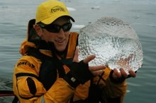
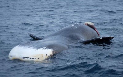
Crossing Barrow Strait on a course of due south we cruised past a massive floating Bowhead whale, lying on its back the rotting beast lay stagnant.

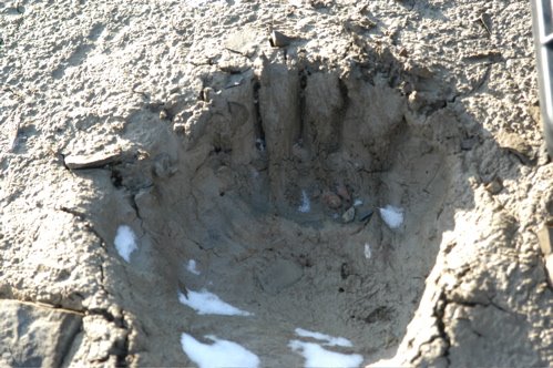
Entering Peel Sound and Franklin Strait we pausesd in Fitsroy Inlet and viewed our first Polar Bear of the voyage. A mature female and her cub moved along the shore 150m from the zodiac’s.
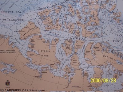
Franklin Strait and the waters surrounding King William Island is believed to be the location where Franklin’s men abandoned their ships the Erebus and Terror. During 1845-1847 Sir James Franklin lead an expedition at age 59 years to complete North West Passage. The expedition was fraught with starvation, cannibalism and misfortune as all 128 men perished.
As a result of the ships being equipped with supplies to sustain the men for three years no search parties were sent out to look for the men until late in 1847. Fifty land and sea expeditions were sent during the preceding years to unlock the mystery of Franklin’s fate.
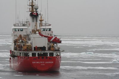
Moving on, we met with the Sir Winfrid Laurier, a Canadian icebreaker who would escort us through Icebreaker channel. Our ice charts displayed more pack ice than actually existed and so their services were not crucial to our voyage. However we did follow behind for a couple of hours bashing through what ice was about.


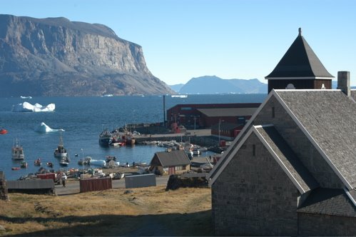
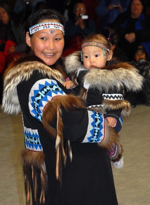
28th – Cambridge Bay, community visit, cultural show.


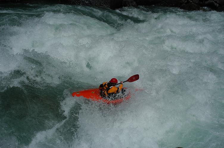
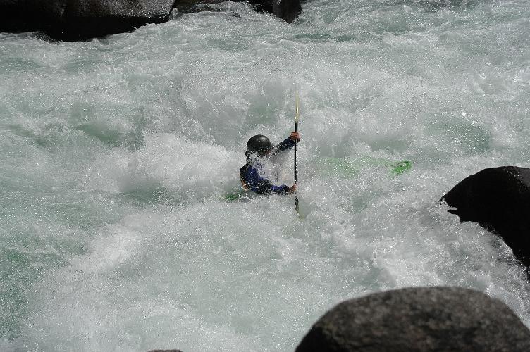
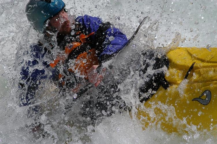
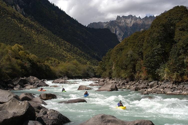
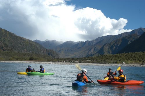
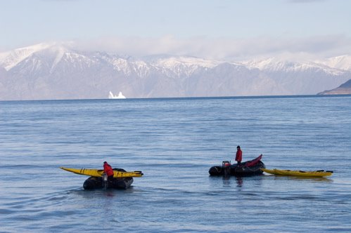
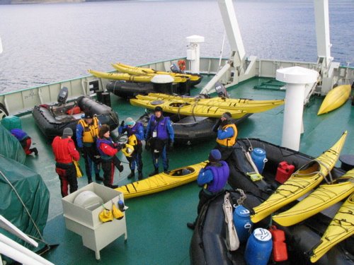
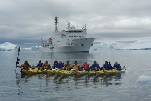
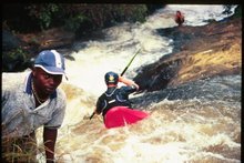
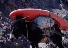
29th - Johansen Bay – kayakers paddled 13km around the Richardson and Edinburgh Islands.
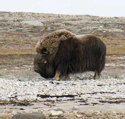
30th – Lady Richardson Bay. Kayaking team float down wind observing a massive bull Muskox for 1.5 hours.

31st - Holman – Amudsen Gulf. Marked the completion of our transit of the North West Passage. We climbed high onto a prominent peak overlooking the surrounding bays
1st - Dolphin and Union Strait
2nd - Dease Strait
3rd – Larsen Sound
4th - Ballot Strait, Gulf of Boothia
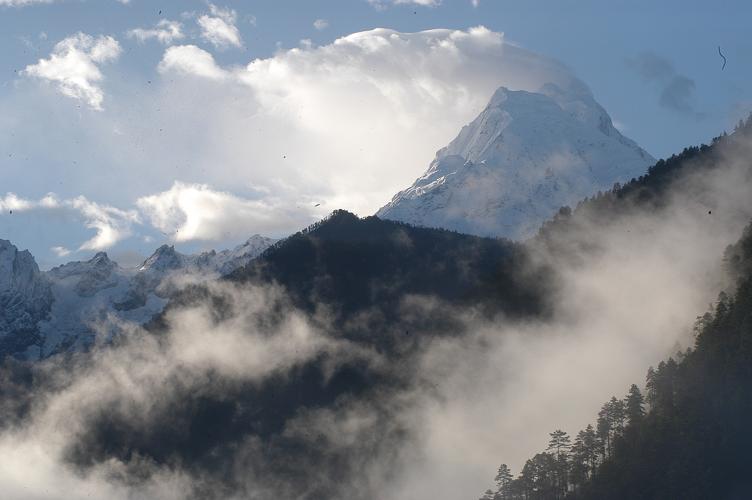
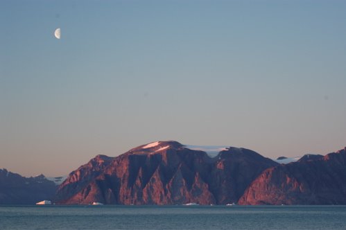
5th – Maxwell Bay, Lancaster Sound
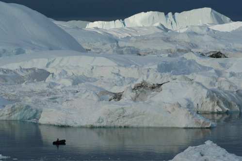
6th – Radstock Bay – Caswall Tower, huge rock buttress, whale bone, bowhead skulls, shelters, built 1000 years ago.
Kayaked at Beechy Island, sand bar provided protection, then we ran downwind with 25 knots to the Northumberland House site.
7th – Voyage completed

Northwest Passage
In 2005 Id had 3 weeks to prepare myself for the South Atlantic Ocean and the frozen environment of the sub Antarctic islands of South Georgia.
August 22nd 2006 I received a sat phone call from high in the Canadian Arctic, it was a chance to this time venture north and was completely unexpected. Three days later after a frantic effort to pack and finish up my season in California I suddenly found myself on route to Ottawa, Canada.
The last charter flight landed down in Resolute, an isolated village situated on Cornwallis Island, Nunuvut. At 72° North Cornwallis Island is situated in the Parry Channel.
For the next 26 days I would work for an expedition cruise company called Peregrine, onboard a ship called “Akademik Ioffe”. My role as part of a large staff comprised of naturalists, lecturers, wildlife specialists, history buffs, zodiac drivers and logistics coordinators was to deliver an adventurous sea-kayaking program.

With all passengers onboard we pulled anchor and left Resolute. It was a memorable time; suddenly I was aboard a huge 115 metre Russian ship, built in Finland embarking on a journey to complete a transit of the incredibly famous and for a long time highly sought after North-West Passage.

Standing up high on the sixth deck I struggled to believe my fortune. I was stunned, questioning why I was the one to be so fortunate, I shook my head and laughed to myself, stoked, completely stoked. Here I was setting off into a part of the world busting at the seams with Inuit culture, uninhabited terrain, exploration history and legendary stories of explorers, the hardship they endured and the men who’s lives were lost in the pursuit of the foreign lands and hidden waterways.


For most the chance to travel to the high Arctic and retrace the paths of previous expedition vessels would be something worked towards and dreamed about for years. An overwhelming level of enthusiasm and interest would surround the opportunity. The chance to see the waters that the Gjoa first navigated, Amudsen’s small ship which he successfully navigated through the North West Passage in 1903-1905. Men with names such as Franklin, Ross, Parry, Richardson, Mc Clintock and Rae who pushed the envelope enduring long harsh winters, their ships locked in pack ice, men who traveled miles and miles overland mapping the internal waterways and coastline of Northern Canada. Their exploration of un-chartered waterways and landscapes never seen by white people collectively opened a passage linking the Atlantic to the Pacific. This highly sought after route linking predominantly traffic from Europe to Asia would open up an alternative path for trade exchange.


With the vast channels, inlets, straits and islands ahead of us our transit of the North-West Passage began. Destination Amudsen Gulf and the Beaufort Sea.

Tuesday, August 08, 2006

Looking ahead, Counting down, Tibet xpd


Consequences for being off line, check mate, rock meets shoulder in Fordyce creek.

Working teaching kayaking more so than any other season, the river scene has been active.
Working sitting in a kayak six days out of seven its income that is certainly welcomed as I gear
up for an exploratory whitewater expedition, another adventure and travel to the worlds highest country, the "Roof of the World" Tibet
Sep 22 our team will colectively meet in Beijing, China!


Ben Jackson, poised and ready, South Fork American river.


"Looks dangerous Odette" Keep the nose up shallow landing


Facial expressions, Brad Brewer captured in the moment