
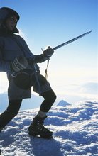
 Mikey Abbott and Andy Phillips inspect the biggest drop of day one.
All images Zak Shaw
The sun didn’t hit our camp early enough for us to consider hanging around to dry gear out so with all equipment loaded in our boats we pushed out into a busy class 4+ section before 9am.With day one behind us and only seven kilometers covered we needed to get an early start. Darkness fell in the Towang Chu at around 5.30pm, so we began looking for campsites at 3.30pm each day.

Image - Typically Towang Chu, the team enjoy some of the continous whitewater day2.

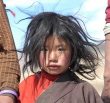
Image - Mikey Abbott tries on a rural hand stitched fur garment!
The whitewater of day two was relentless. We didn’t find to many individual drops, each big move just seemed to flow and push into the next. The gradient was right on that wonderful verge of almost being to much the entire day. We took very few breaks in order to try and push through the steepest part of the canyon. That didn’t happen. I remember saying “I wonder if this river is going to take two days or four”
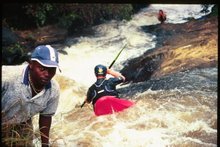
 Image - Andy gets it right on a chunky lead in rapid above bigger things below. Note the slip and blasting debris upstream.
In the middle of the day climbed a slip overlooking a beautiful gorge. Not all lines to get through looked that great from our high vantage point, we looked at trying to get around things at water level but decided against it. I wasn’t feeling particularly sharp that day and after more discussion we all portaged. Whilst most of our attention was focused on things at water level, we also had to look up! BRO, India’s organisation with the responsiblity of road construction were at work all day everyday. Communities, shacks, people on the downhill side of all road blasting are not really a huge concern to them and their progress. These roads cut into massive hillsides and over summit passes opening up rural India. On river left the entire bank would look like a bombsite with trees slashed down the forest destroyed by falling rock. In our kayaks we made quick progress through these zones, and avoided dwelling in eddies for unnecessary periods of time in case of new landslides were set off. It was pretty nerve racking. The blasting meant we always had to keep an eye out for massive trees in the flow. In camp at the start of day three, another thunderous blast sounded. We had set ourselves up in river right hoping any landslide from river left would not make it to camp should dynamite be set off directly above us. Andy at the time had left camp to use the little boys room. Upstream of our camp the bus sized boulders ripped down the hillside and stripped the forest clean. Mature trees were literally slashed like blades of grass. The boulders then jumped and completely cleared the river without contact hitting the far bank, our bank! We got dressed and left quickly.
 Mikey and Sam on breakfast duty early day three.
 Day three was more of the same, continous, big and pushy. Using our topographical map and GPS in camp we had identified the rivers steepest section, it still lay downstream. We portaged easily on a well formed track beside the river and continued on.

Image - Mikey Abbott mid way through one of the last big rapids of day three.

The challenge with the Tawang Chu then came in finding a place to stop. Five kilometers upsteam of the border of Bhutan we found another steep bedrock gorge. Before starting our descent we had seen a few tracks that would help us during our climb out from river level to a road. We talked to Shalab and Sangrup on the radio before walking with our kayaks and gear, we also ate all our food! to save weight for the climb out.

Image - Nearing dark Sam Hughes packs his laden kayak and loves every minute of it!
We gained 460 vertical metres using an overgrown track to the truck. Half of our effort was in the dark but Sangrup had scrambled down to meet us as night fell, he then guided us up to the truck. After 2.5 hours we had the job done.
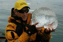
Image - Earned. Sam finds the rum and begins celebrations.

Image - At the top. When we arrived at the truck we didn't feel like moving much further.

Image - At the top. When we arrived at the truck we didn't feel like moving much further.


No comments:
Post a Comment