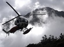
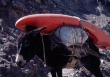
Order calendars via zakshawphotography@gmail.com or the secure Paypal option below.

Order calendars via zakshawphotography@gmail.com or the secure Paypal option below.
My 2014 calendar was entirely photographed on the western side of New Zealand's Southern Alps. "Land in the West" is printed at a size of A4 with twelve calendar month pages displaying stunning outdoor environment photographs. Take a look at my Facebook page to view all twelve 2014 calendar images! Order here via Paypal or email me at zakshawphotography@gmail.com if you would prefer to pay with online banking. Thanks for your support!
Calendar sales within NZ
Calendar sales international

Thursday, April 03, 2008

Dropping into Harwoods Hole!

Image - Zak Shaw
A wild place; Mick Hopkinson and Ben Jackson near the end of their 180m abseil into Harwoods Hole and the Starlight Cave system. Our NZ Kayak School instructional team recently got off the water and underground!

Thursday, February 28, 2008

Antarctica!!!!! The 7th Continent

My first sighting of continental Antarctica
Image - Zak Shaw

Links - Hayley Shephard - www.kayakingtosavealbatross.com - First solo attempt to sea kayak around South Georgia January 2009. Funds raised will go to the save the albatross fund and continue to educate commercial fisheries in the southern ocean.
Image Zak Shaw - A Wandering Albatross enjoying the unimpeded winds south of Cape Horn. These latitudes are home to many Albatross and famous for their violent storms that circulate the globe completely un-interupted by landmass.
Robert Swan - www.2041.com - The first person to walk to both poles and leader of project 2041 the year the Antarctic treaty comes up for renewal.

Image - Stephen Curtain

Again I found myself standing on the top deck of the ship wondering how the hell I managed to get myself there! Looking out over the town of Ushuaia it finally set in, where I was about to go!
Image Zak Shaw - Onboard the Akedemik Sergey Vavilov - Crossing the legendary Drake Passage. The Drake is either referred to as the "Drake lake" or you experience the "Drake shake" All season I waited with anticipation for gail-force winds and massive seas. Things got big but a true southern ocean storm never really arrived.


Sea Kayak Guiding, image taken in Neumayer Channel, Antarctic Peninsula

Onboard the "Northhanger" in 2005 after the successful Adventure Philosophy teams "Around South Georgia" expedition we had sailed painfully slow past Isla de los Estados and up into the Beagal Channel of Tierra Del Fuego. Dogged by wind we limped towards Puerto Williams, we were running late and I had a flight to catch!
I'd seen more of South Georgia than most and probably thrown up more than most during our brutal nine day crossing back across the South Atlantic to the Falkland Islands.
As we entered the Beagal Channel I remember looking south and wondering when I may next be at sea and traveling south of Cape Horn.
My chance has come through Peregrine Adventures and my work as a sea kayak guide both in the High Arctic and now in the southern ocean surrounding Antarctica.

In Whilhelmina Bay (Whalehelmina) we didn't even bother getting in the kayaks, Humpback Whales came to us! Incredible, Unreal.
Image - Mark Fitzsimmons, Australia www.blueskyhelicopters.com

Sea kayak guiding in fog and heavy snow storms. Where's the ship? Location Neko Harbour. GPS in hand Goto waypoint = the next massive ice-berg, hot showers and more dessert!
Image - Jorge Ordonez

Cuverville island the temporary home to hundreds of breeding Gentoo Penguins.
Image - Zak Shaw

Everywhere you look Antarctica is impressive.
Image Zak Shaw - Lemaire Channel

Image - Eric Pekar
That's a big whale and thats a small kayak! Ranging between 13 and 15m in length Humpback Whales weigh between 25 to 40 tons (22,680-36,287 kg). They breach and exhale wind gust like plumes of showering spray and bad breath. Ultimately thats alot of blubber breaching and fluking beside you. All I know is that when one is this close to you is thats its quite possibly one of the most amazing experiences ever.


How cool is that! Paddling along the shores of Cuverville Island five massive Humpback Whales surfaced around us for an hour! High times in Antarctica!
Image - Eric Pekar

Image - Zak Shaw

I return to New Zealand this week on the backside of one months work off the Antarctic Peninsula and South Shetland Islands.

Tuesday, January 15, 2008

New Zealands Waitaha under threat

Its the classic river dichotomy. To construct a single turbine hydro scheme or relise that 40mw of power is bugger all and the sacrifice is far from being worth it. This time its the Waitaha that will be exploited. We stand to loose one of New Zealand's most stunning river gorges, the Morgan Gorge. An area of pristine wilderness and supreme beauty the Waitaha river in years to come will find itself becoming increasingly threatened.

Ben Jackson gearing up for a big day on the Waitaha.
Image - Zak Shaw

The list of rivers targeted on NZ's West Coast is not limited to the Waitaha. The Arnold, Mokihinui, Taipo, Taramakau and Wanganui either have plans in effect or are seen as potentials for "renewable energy"

Image - Zak Shaw - The spectacular Morgan Gorge.
The entrance to Morgan Gorge is where the proposed dam would be situated. This image was taken from a swing-bridge which spans the impressive gorge below. Visiting trampers use the bridge to access the rugged Hitchin range to the east.

Below is a short video file Ben jackson put together after our recent kayaking trip into the Waitaha. Enjoy!!


The main Waitaha track itself is challenging but provides access up the Waitaha river and the isolated Scamper Torrent hut. This four bunk hut rests directly below the craggy slopes of Mt Durward on the western side of the main divide.
"South Island Weekend Tramps" by Nick Groves has a full rundown of the options for tramping in the Smyth Range and greater Waitaha river drainage.

Last week a team of us from the NZ Kayak School made the drive from Murchison to the Waitaha River. We flew to Moonbeam hut, it was a huge day out but well worth it!
Image - Zak Shaw, Matt Shearer gets it right on one of the Waitaha's crux drops

Seal Launch! Its an intimidating one, but the rapid below is deep.
Mick Hopkinson gives Matt a shove out and away from a small ledge
in the middle of the third gorge. With no one to give you a
push who's going to go last?
Image - Zak Shaw
Image - Zak Shaw, Ben Jackson shows his battle scars mid way through the 1.5 hour kayak carrying/dragging/climbing portage up and around Morgan Gorge.


Image - Zak Shaw, The Waitaha portage. Its a good thing that it comes late in the day! You have paddled most but not all of whitewater the Waitaha will through at you by this point.

The Waitaha is a big day by anyone's standards. Most parties take between six and nine hours to break down the continuous class 4-5 rapids that exist below Moonbeam hut. The difficulty of the whitewater is un-relenting and is mostly found in several committing bedrock gorges.
Once the third gorge opens out and the valley walls widen the intensity backs off briefly before smooth schist walls rise again and the river dramatically carves its way into the heart of Morgan gorge.

It doesn't get much better. Like most west coast rivers the Waitaha river flows through an environment second to none, one you can paddle through! Image - Mick Hopkinson, Ben Jackson and Matty Shearer cashing in on some scenic dollars.
Image - Zak Shaw

The following images were shot during a 2007 descent of the Waitaha.

Paddler - Eden Sinclair
Image - Zak Shaw
Paddlers - Gareth Friar, Eden Sinclair and Oli from Wyoming.
Image - Zak Shaw

Typically Waitaha.
Image - Zak Shaw

Follow - www.rivers.org.nz for future updates regarding NZ rivers and the Waitaha project.

Comments welcomed.


Saturday, December 22, 2007

Tenga, Dirang, Kameng, Arunachal Pradesh

Image - Zak Shaw , Buddhist Stupa in the heads of the Namjang catchment.


Doesn't every team scout like this? The most western catchment in Arunachal Pradesh is that of the Namjang. Its a big tributary of the Towang Chu. We took a morning to rest after our climb out of the Towang Chu, drank buckets loads of sweet chai and planned our next move.

Team scout, we take it pretty seriously.


The Namjang looks awesome if you have these two images painting the picture. We looked at it for a full day before paddling a short section close to the road. The lower gorge was calculated as being steeper than the Towang (not what we wanted) and yet most of our scouting from high above revealed a big lower canyon, lots of flat water, some easy stuff and several obvious portages where the river went ballistic.


Indian wilderness, Super scenic, Andy Phillips on the Namjang.
Image - Zak Shaw

Time was running low. Whilst we had been paddling the Namjang, Sangrup had hitched a ride back to Tawang to pick up a fax. Our permit was due to expire and before heading back east we needed a ten day extension.
We drove all night back up and over Se La, the summit pass road before dropping back into the Dirang drainage. That afternoon we quickly packed our kayaks and set off down the Tenga river. The Tenga gorge is 14km long before it joins the Dirang.
We had no real idea of what the gorge would contain. We estimated an average gradient of 20m/km but got a bit nervous when after three kilometres the small creek we were on slotted up into a bedrock box canyon.

Image - Leaving camp at the start of day 2. We all felt like the day would be great or it would be a massive hike out back to the put in, its just had that feel about it. As it turned out the whole gorge was tight and constricted but it dropped consistently creating some great rapids and clean drops. Around every smooth water-worn corner we waited for a big chocked up boulder jumble but it never came.


Image - Mikey Abbott gets a gets out and away off one of the many classic drops in the Tenga gorge.
Image - Camp 2 Tenga.

Image - More of the good stuff above the Dirang/ Tenga confluence. Sam Hughes and Al Ellard get amongst it.
At about lunchtime on day three we found the Dirang river and more water. It was great, one of the things we had talked about with the trip prior to starting was that it would change dramatically in size once the two big rivers joined.
We stopped for a huge feed of roti, rice, chai, beer, pork fat and dhal in a small village mid afternoon before floating down to camp. (Ah the beauties of rural asia!)


Image - Dramatic lighting on the Kameng River Day 4.

Day four we paddled 45km from the Dirang/Kameng confluence to a town called Bhalukpong.
It was an awesome last day, packed with big volume class 4 whitewater and huge surfwaves.

My last day on the river in India was a good one but hadn't quite finished when Shalab whilst loading kayaks onto the roof racks of the truck slipped and managed to get his leg caught in the bull bars of the truck. He fell with his leg trapped to the ground and snapped his Tibia, the noise was brutal. Our celebrations of a great trip were suddenly postponed as we splinted Shalab's leg, loaded the truck and drove to Tezpur and an Airforce base three hours away.

Zak Shaw

Wednesday, December 19, 2007

Dodging landslides, life on the Towang Chu, First descent completed, Nov 29th

We were forced to climb up above a heinously steep section not far above our camp for the night and the end of day one.
Mikey Abbott and Andy Phillips inspect the biggest drop of day one.
All images Zak Shaw
The sun didn’t hit our camp early enough for us to consider hanging around to dry gear out so with all equipment loaded in our boats we pushed out into a busy class 4+ section before 9am.With day one behind us and only seven kilometers covered we needed to get an early start. Darkness fell in the Towang Chu at around 5.30pm, so we began looking for campsites at 3.30pm each day.

Image - Typically Towang Chu, the team enjoy some of the continous whitewater day2.


Image - Mikey Abbott tries on a rural hand stitched fur garment!

The whitewater of day two was relentless. We didn’t find to many individual drops, each big move just seemed to flow and push into the next. The gradient was right on that wonderful verge of almost being to much the entire day. We took very few breaks in order to try and push through the steepest part of the canyon. That didn’t happen. I remember saying “I wonder if this river is going to take two days or four”

Image - Andy gets it right on a chunky lead in rapid above bigger things below. Note the slip and blasting debris upstream.

In the middle of the day climbed a slip overlooking a beautiful gorge. Not all lines to get through looked that great from our high vantage point, we looked at trying to get around things at water level but decided against it. I wasn’t feeling particularly sharp that day and after more discussion we all portaged. Whilst most of our attention was focused on things at water level, we also had to look up! BRO, India’s organisation with the responsiblity of road construction were at work all day everyday. Communities, shacks, people on the downhill side of all road blasting are not really a huge concern to them and their progress. These roads cut into massive hillsides and over summit passes opening up rural India. On river left the entire bank would look like a bombsite with trees slashed down the forest destroyed by falling rock. In our kayaks we made quick progress through these zones, and avoided dwelling in eddies for unnecessary periods of time in case of new landslides were set off. It was pretty nerve racking. The blasting meant we always had to keep an eye out for massive trees in the flow. In camp at the start of day three, another thunderous blast sounded. We had set ourselves up in river right hoping any landslide from river left would not make it to camp should dynamite be set off directly above us. Andy at the time had left camp to use the little boys room. Upstream of our camp the bus sized boulders ripped down the hillside and stripped the forest clean. Mature trees were literally slashed like blades of grass. The boulders then jumped and completely cleared the river without contact hitting the far bank, our bank! We got dressed and left quickly.

Mikey and Sam on breakfast duty early day three.
Day three was more of the same, continous, big and pushy. Using our topographical map and GPS in camp we had identified the rivers steepest section, it still lay downstream. We portaged easily on a well formed track beside the river and continued on.

Image - Mikey Abbott mid way through one of the last big rapids of day three.


The challenge with the Tawang Chu then came in finding a place to stop. Five kilometers upsteam of the border of Bhutan we found another steep bedrock gorge. Before starting our descent we had seen a few tracks that would help us during our climb out from river level to a road. We talked to Shalab and Sangrup on the radio before walking with our kayaks and gear, we also ate all our food! to save weight for the climb out.


Image - Nearing dark Sam Hughes packs his laden kayak and loves every minute of it!

We gained 460 vertical metres using an overgrown track to the truck. Half of our effort was in the dark but Sangrup had scrambled down to meet us as night fell, he then guided us up to the truck. After 2.5 hours we had the job done.

Image - Earned. Sam finds the rum and begins celebrations.


Image - At the top. When we arrived at the truck we didn't feel like moving much further.


Friday, December 14, 2007

Finding the Towang Chu, November 19th

The three day drive across Nepal and back into India went quickly. Along the way we gained impressive views of the Himalaya's and local people working the land.
Image - Zak Shaw
In Guwahati one of the major towns in the Indian province of Assam we met up with Andy Phillips our final team member. Assam is India's most populated province and the town of Guwahati never slept. Everything that happened did so at one hundred miles an hour. Stepping from the relative quiet of the hotel onto the main drag was such an abrupt change.

Kayaking travel isn't all about beautiful rivers, classic drops and glossy photographs. Make sure you pick the urinal which has its drainage pipe running under the floor and not on your feet! Allan Ellard holds his breath and gets ready to leave!

Chai stop, more masti more fun! One of the best thing about India is the signs! On the road we made regular stops to rehydrate by drinking Chai. As you can imagine we got alot of mileage out of the Chai Time Masti signs!

Will you make us Chai? Ah on second thoughts maybe not! Mikey Abbott not happy about what's on the menu!

Image - Zak Shaw - Sangrup pulls us through another turn.
From Guwahati we made good progress across the plains before the countryside got steep. In Bhalukpong we made our official entrance crossing the border into Arunachal Pradesh. India's roading is astounding. Near the border with Bhutan we drove for a full day up switchback after switchback until we finally topped out at Se La. Rolling over the 14,700ft pass signaled our arrival into the Towang Chu catchment. Jang is a village of reasonable size at river level in the heads of the Towang Chu, it was a great place to eat our favourite meal dhal with rice and roti. We gathered more info from the locals about the river before we continued on. Five hours later we had managed to gain 4 mere kilometres upstream before it got dark. Sometimes switchbacks are not to effective!

Image Zak Shaw - Mikey Abbott at sunset.

Image - our shelter for the night.
It was probably one of the coldest nights of our time in India. We crowded around a smokey fire inside the shacks drinking chai for a few hours before the smoke became to much. Their shelters were not eqipped with any form of chimney so we sat on the floor and drank with our bodies as low as possible. A group of local men were posted here for the entire winter, their job is to keep the road in good order.


Image Zak Shaw - The Upper Towang Chu valley
Its big country! to gain an idea of scale the river is the faint snaking white streak in the bottom left of the image.
With river access and proving to be more than challenging upriver we returned to Jang and set about gathering information about the 30km downstream towards the Bhutan border.
Buddhism is the main religion in this remote far western region. In Tawang we visited the Tawang monastery and did another day of driving downriver in an attempt to site a take out possibility before Bhutan.

Image Zak Shaw - Young monks heading off to attend one of the day's prayer sessions.

Image Zak Shaw - Inside the Tawang Monastery.

Image Zak Shaw - Local woman with a traditional spiked yaks wool hat.

Finally now some kayaking! After quite possibly the most driving weve ever done to get get wet on a river we geared up and set off down the Towang Chu. The first day of our three day, 30km first descent was brilliant. We put in at an elevation of 2000m below Jang. The first few moves were great and made the boys grin from ear to ear. We covered 7km of pushy whitewater mostly class 4+. At 3.30pm we pulled into a camp anticipating darkness at 5.30
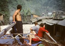
Check in here in a couple of days for more action. Im flying home to NZ and should get some time on the plane to get a few thoughts written up!


Image Zak Shaw - Boatscoutable class 4+ Al Ellard enjoys one of the first moves during day one of our Towang Chu first descent. (November 27th)