
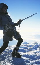
 The crucial junction. Dont miss this one. Make a false move and you'll end up in Gore.....
Image - Zak Shaw
This week we rallied for a second time into the Waikaia River valley. A hail storm pelted the van and ominous southerly driven clouds hung over the hills. The cold snap had locked up the remaining snow pack on the Old Man and Garvie Range and the Waikaia flow had diminished.
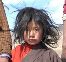
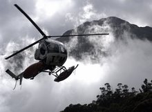
 Optimistic that we would still have enough to float Keith and I recruited our man at High Country Heli and the job was on.
 Image - Zak Shaw
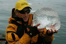
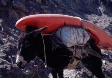
West meets East. Our flight took us over the West Waikaia River. It looked low but manageable so our pilot released the strop holding the kayaks airborne over the tussock.
It was great to be back in the heads of the Waikaia! Surrounded by stunning alpine scenery and with time on our side we chilled out for an hour or so and walked up towards the Garvie snow slopes. Our belief was that the west Waikaia would be a solid day trip but after our first 500m of river travel we called it quits. Several sieves, portages and trickle of water to move around on had us revising our day out and the West meets East Waikaia trip was born.
 Open tussock travel with a kayak is in relative terms quite easy. We climbed at first avoiding Spaniard grass spears and after an hour we had broken the back on the climb and began our sliding, dragging descent into the East branch.
Image - Zak Shaw
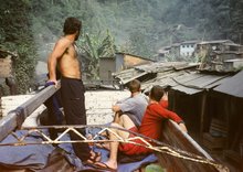
Our hike over positioned us a long way up the East and at 3pm we began what a week before had taken three days. By 7pm Keith and I had bombed the day one section, abandoned the kayaks and begun our 2hr hike out.
 Image - Zak Shaw
Day two - Dylan showed up with a 4wd and we got back into our gear without much effort.
We remembered the river well. Most of the rapids were still on and throughout the day we ticked off a few drops and moves that had been too full on a week prior. Regardless of good memory day two still required 8 solid hours of kayaking. We linked the East Waikaia with the West and continued on out to Canton.
 Image - Zak Shaw
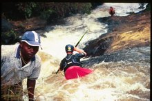
 Keith Riley looking good on a drop that a week before had been a fast paced headhunter. (The rock jutting out from the right)
 Image - Zak Shaw
After the trip I looked at the Southland Council website for the flows -
http://www.es.govt.nz/river-rainfall/index.aspx?data=flow
For this second run we were in there at rock bottom levels that ranged from 11 - 9 cumecs!
I'd expect the flow range for the East Waikaia to sit between 30 and 12 cumecs at Piano Flat
The first descent flows were 29 peak - 16 lowest. (over the three days)
First Descent daily flows - Day 1 - 24 - 18, Day 2 - 29 - 20, Day 3 - 22 - 16


No comments:
Post a Comment